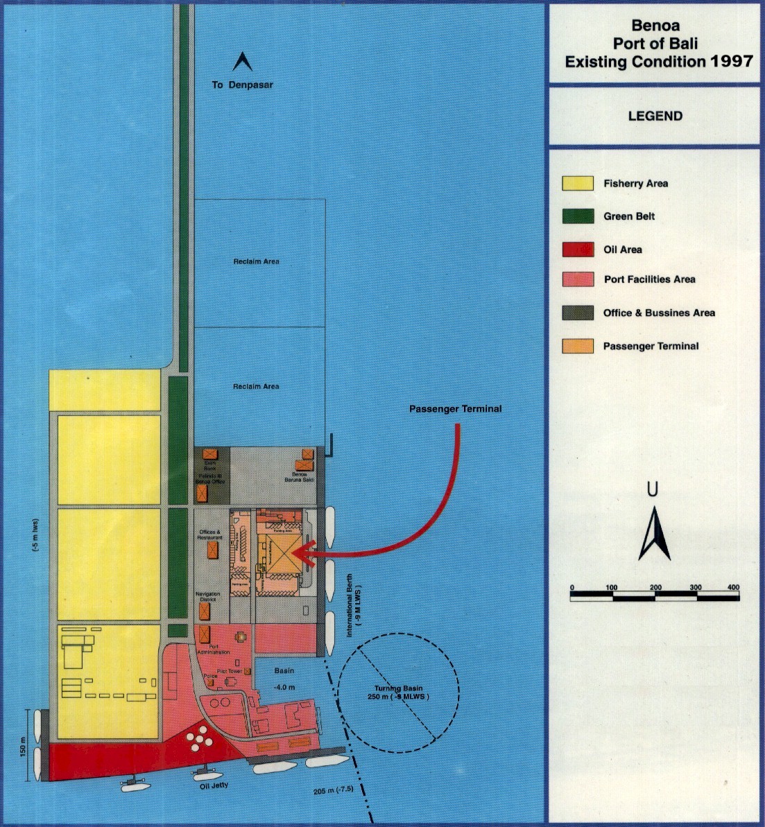
 Port of Benoa Port of Benoa |
PORT AREA |
The area of the port of Benoa covers the waters throught the sea bouy running the left side boundary of navigational channel to the inner road proceed to the west shallow border, from where taking a straight line to the north, following the parallel acces road to Denpasar, as well as the same parallel line at the 600 meters distance to the eastern wharf. Total port area (land) = 52, 150 hectares officially stated by the government under SKB. 15th. 1990. |
|
Water Front Area |
Fishery Zone = 23 Hectares |
| Offices Zone = 7 Hectares |
| Commercial Zones = 22,250 Hectares |
